.png)
.png)
.png)
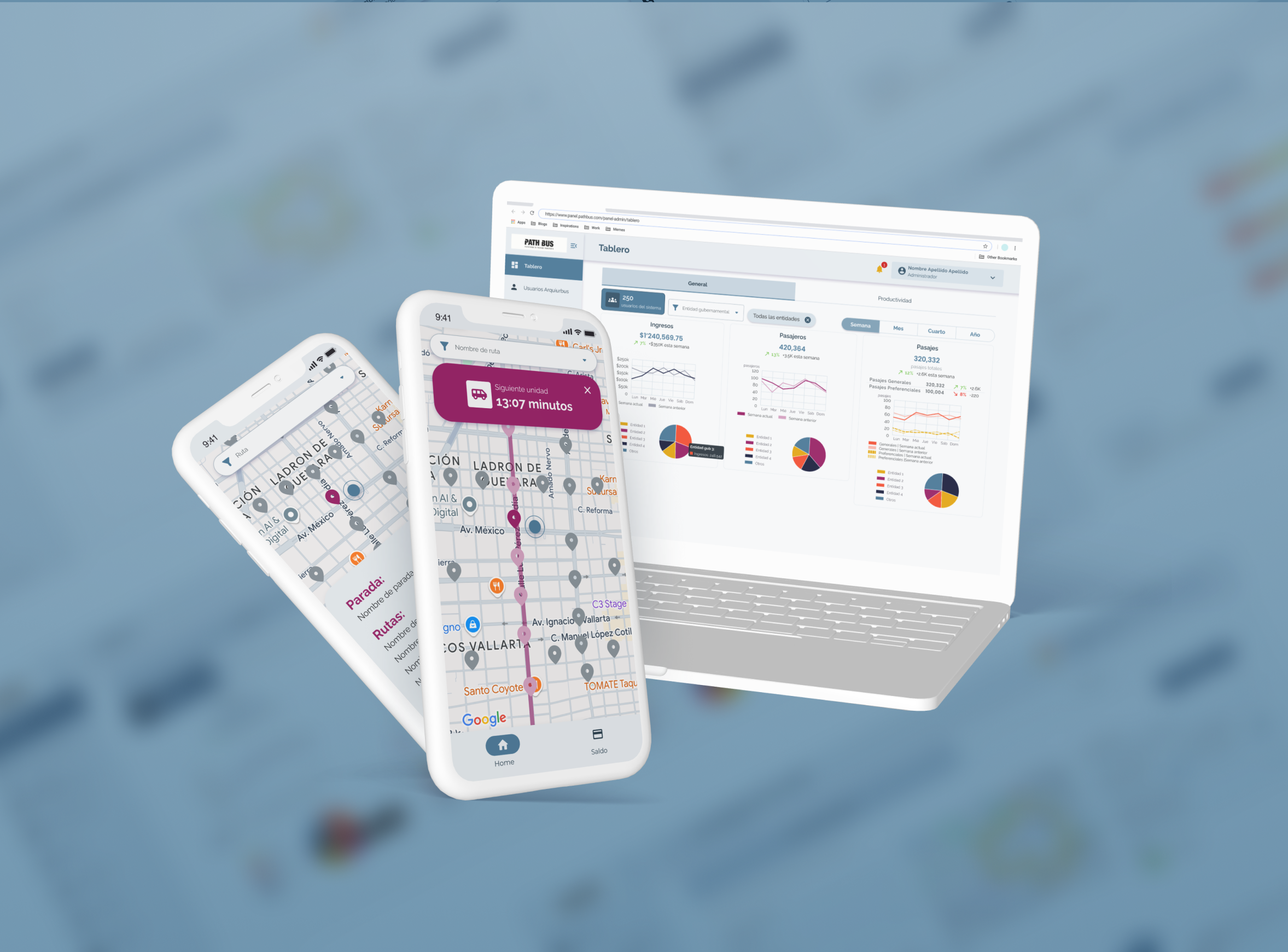
Public Transport Management Platform
At a glance
The challenge
- Unreliable public transportation with unclear routes and arrival times
- Limited visibility into operations for government and operators
- Fragmented data across stakeholders (government, operators, hardware systems)
- Lack of transparency in ticketing and revenue tracking
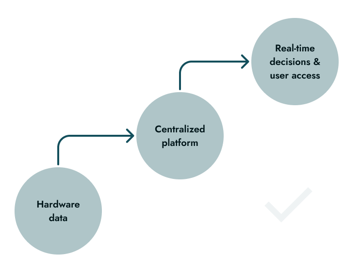
The solution
A unified system that connects hardware, operators, and users to provide real-time visibility into routes, vehicles, and transactions.

Real-time bus tracking

Integrated ticketing data

Multi-stakeholder platform

Hardware + software integration
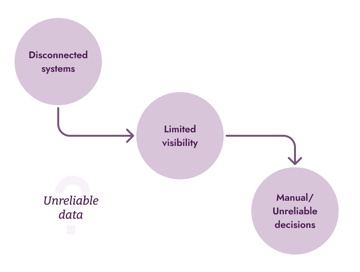
Context
Public transportation decisions were being made with limited visibility and fragmented data.
The client was already working with government initiatives (CDMX) to modernize transportation through hardware systems such as GPS tracking and cashless ticketing. However, there was no unified platform to connect this data, making it difficult to monitor operations, track revenue, or provide reliable information to users.
At the same time, passengers experienced uncertainty daily, such as unclear routes, unpredictable arrival times, and lack of accessible information.
Low trust in public transportation
Fragmented data across areas
Revenue uncertainty
Emerging hardware ecosystem
Before
After
My Role
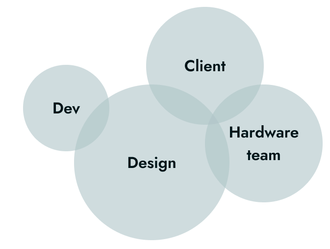
I worked as a solo Product Designer, collaborating closely with software developers, hardware teams, and stakeholders within the public transportation system.
I was deeply involved in understanding how different actors (government, operators, and passengers) interacted with the system, translating those needs into a cohesive digital experience across platforms.
What I owned:
- UX flows for admin dashboard and mobile app
- UI design across platforms
- Interaction design for real-time and data-driven features
- Alignment of user needs across multiple stakeholder types
What I didn't own:
- Hardware design and implementation (GPS, ticketing devices, cameras)
- Development and system architecture
- Final implementation and deployment
Approach and Strategy
Designing Pathbus required balancing real-time system constraints, multiple stakeholders, and the need for clarity across both operational and public facing experiences.

Unified data platform
Unify inputs from GPS, cameras, and ticketing systems into a coherent platform for monitoring and decision making.
.png)
Real time system visibility
Provide accurate, up-to-date information on bus locations and system activity for both operators and users.
.png)
Operational control & access
Allow administrators to manage routes and users, while giving passengers reliable tools to navigate the system.
The system needed to serve very different user types, from government stakeholders to everyday passengers, while maintaining consistency and clarity across experiences.
Key decisions and iterations
Key decisions focused on aligning system complexity with real operational roles, ensuring clarity, control, and usability across all user types.
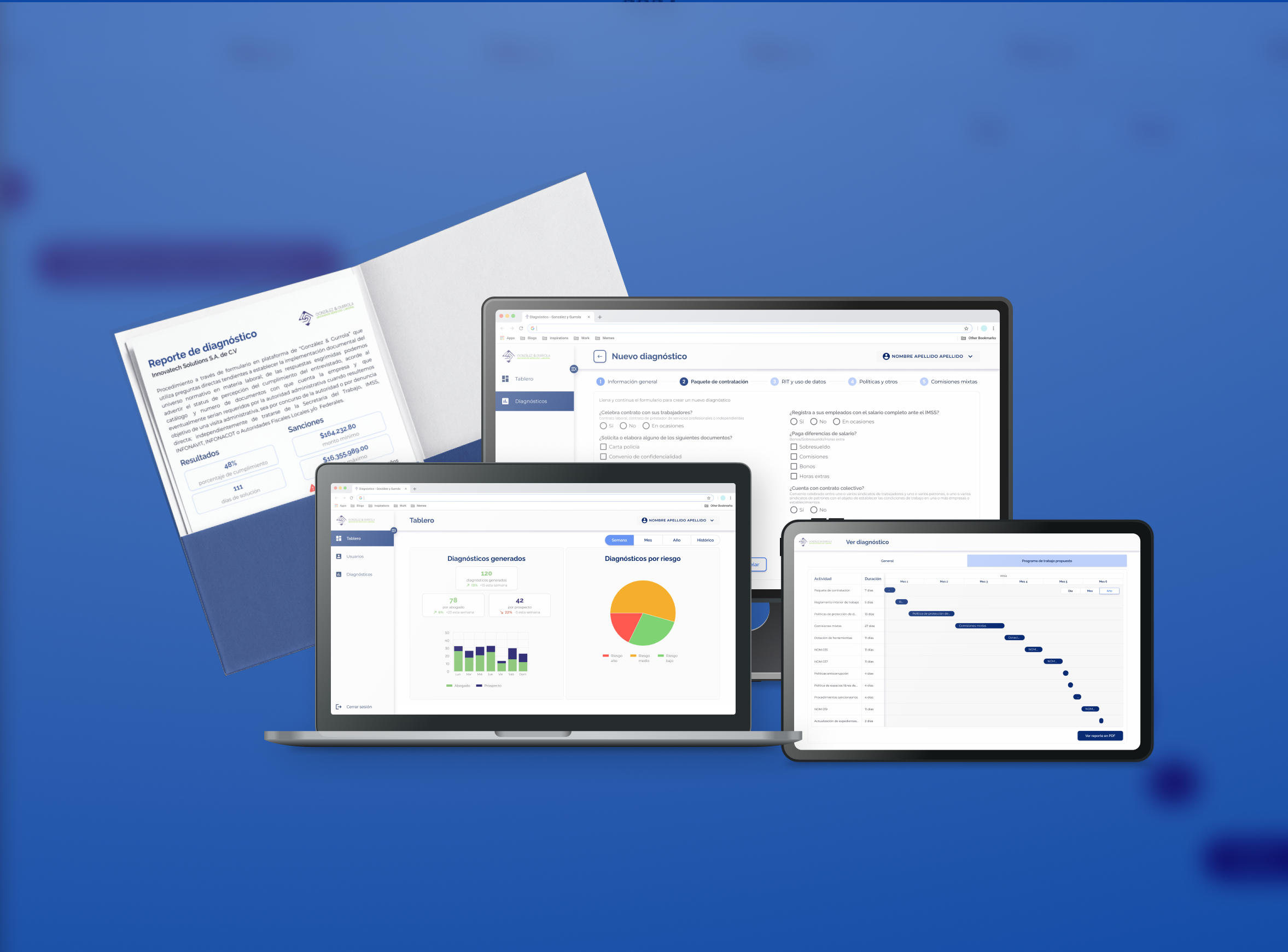
Role based dashboard segmentation
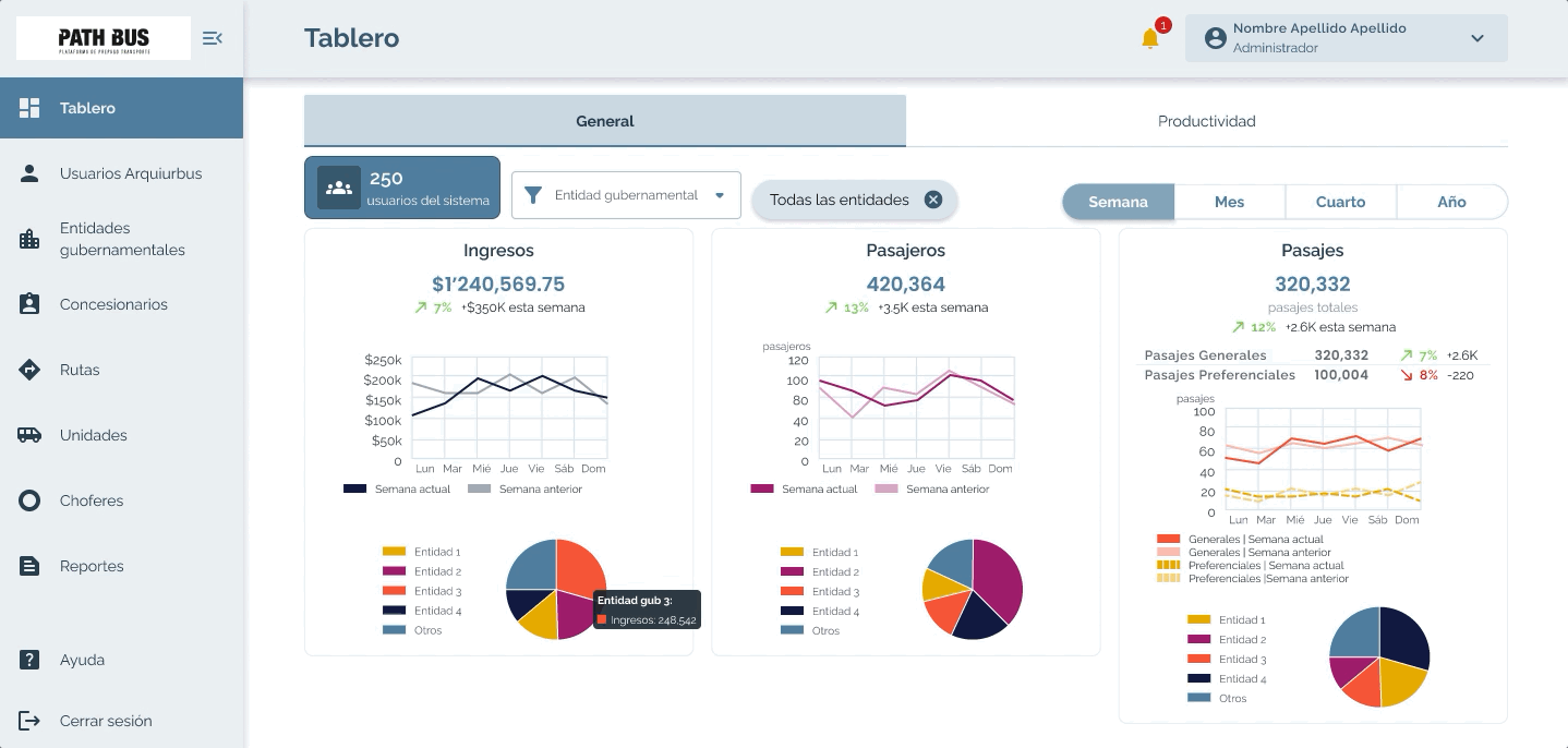
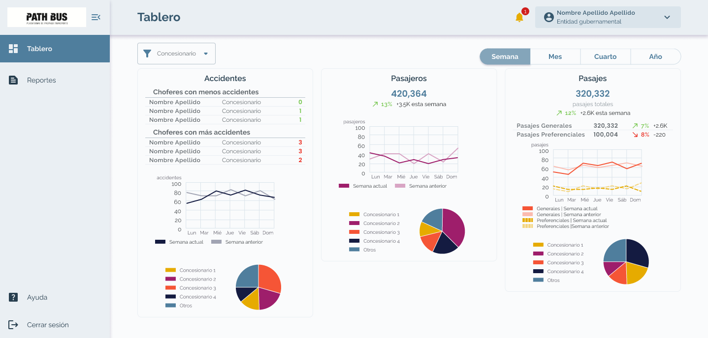
Instead of a single dashboard, information was structured based on user roles: government, admin, and concessionaires (transport operators).
- Government: Focus on service behavior, passenger volume, ticket usage, and incidents to support oversight and transparency. Access to exportable reports for audits.
- Admin: Full system visibility, including revenue tracking, operational performance, and hardware status across regions and routes.
- Concessionaires (operators): Same structure as admin, but limited to their own data to ensure privacy and relevance.
This segmentation ensured each user saw only what was actionable for them, reducing noise while maintaining system-wide consistency.
Guided route creation with map visualization
For this critical task the form was designed to guide users step-by-step, with a live map showing bus stops and route structure in real time.
This reduced errors and improved confidence when configuring routes, especially for complex urban layouts.

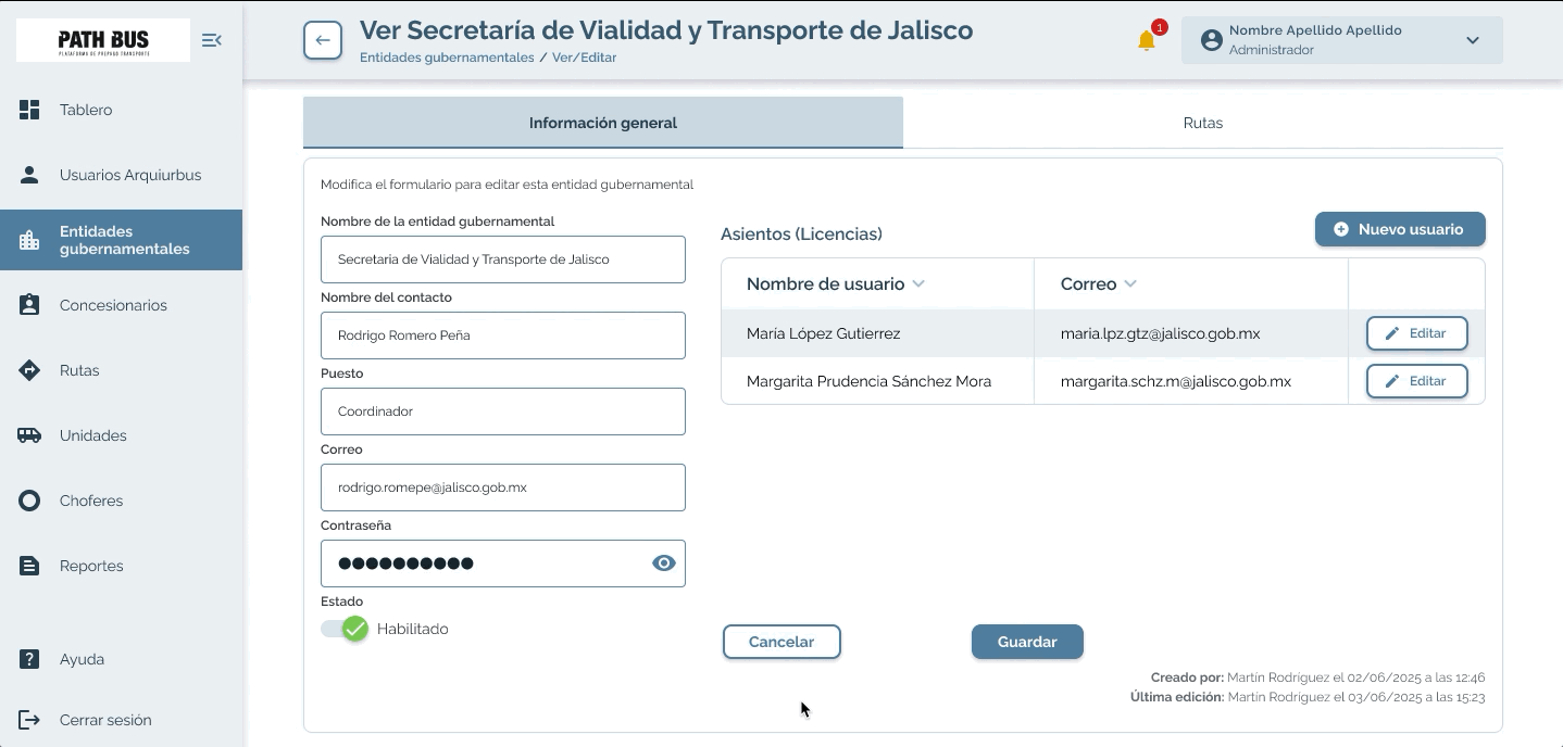
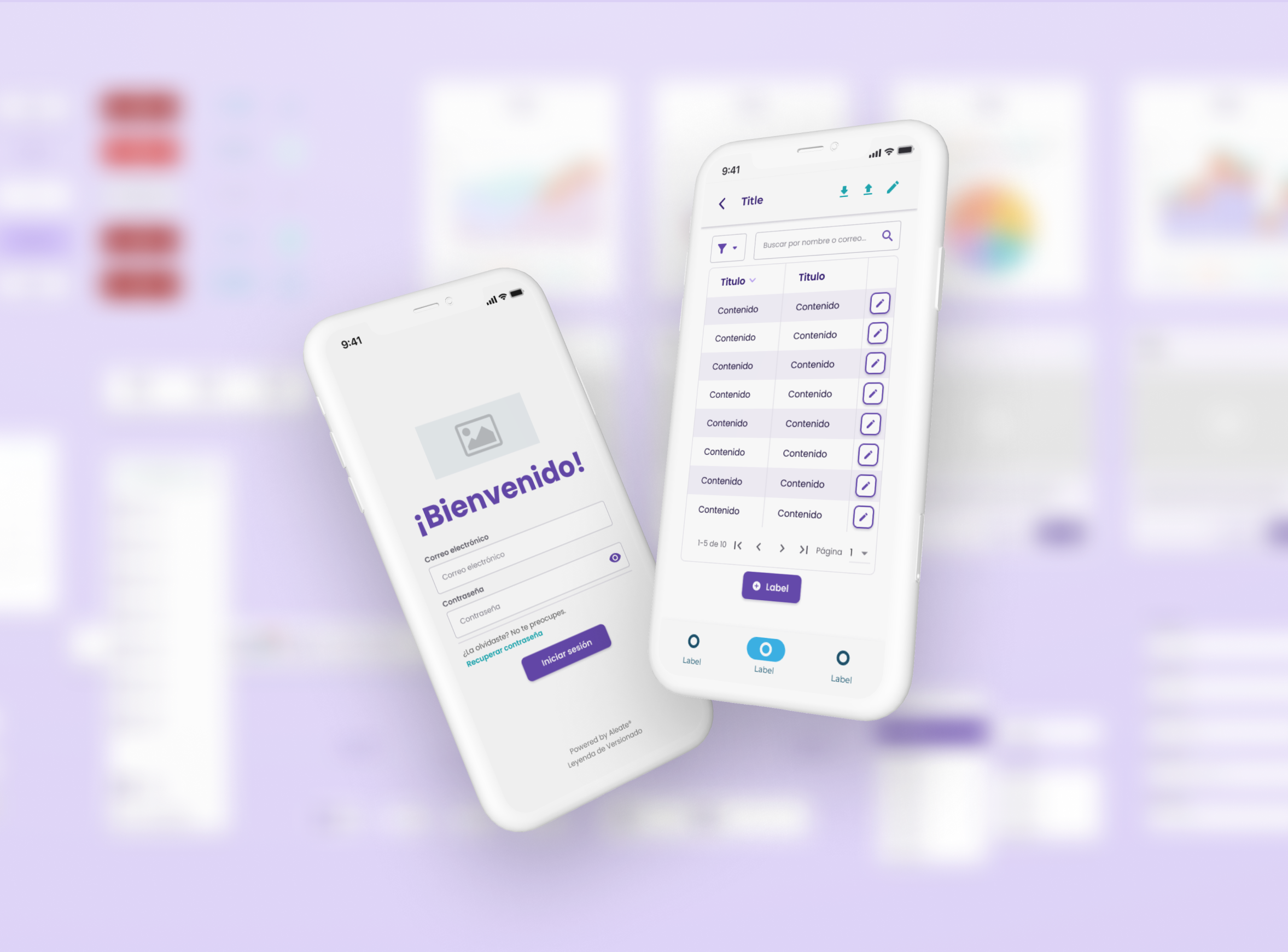
Controlled user creation flow
Access to the system needed to be tightly managed. Admins were the only role able to create users.
The flow was structured in two steps:
- Create a government entity (e.g., city or region)
- Assign users within that entity with predefined credentials
This ensured clear ownership, controlled access, and scalability as the system expanded across regions.
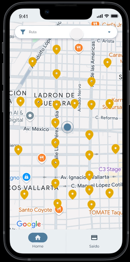
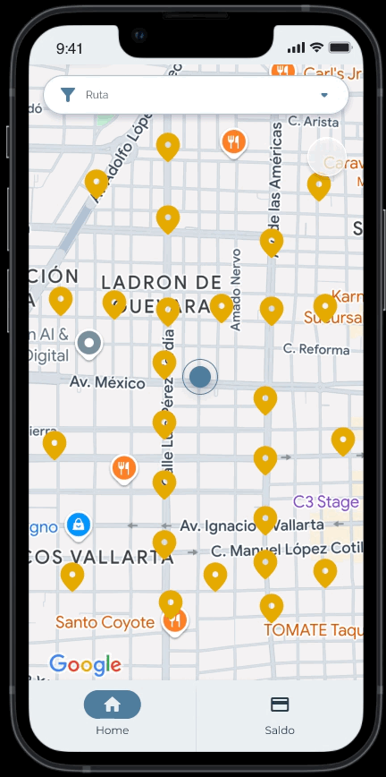
Location-based mobile experience
The mobile app prioritized real-time location to surface relevant information immediately.
Users can:
- See nearby bus stops based on their location
- Track incoming units in real time using GPS data
- Understand how far the next bus is from their stop
This reduced uncertainty and made public transportation more predictable for everyday users.
Collaboration and Alignment
I worked closely with a cross-functional team to align user needs, system constraints, and operational goals across both software and hardware.
- Developers (Full-stack & Mobile):
Iterated through prototypes to validate feasibility early, adapting flows to support real-time data handling and system performance without compromising usability. - Client Project Ambassador:
Collaborated to define required data structures, user roles, and workflows, ensuring the system reflected real operational needs across government and transport operators. - Hardware Team (Industrial & Mechanical):
Aligned on constraints and data flow between GPS, ticketing machines, and onboard cameras, ensuring the digital experience responded accurately to real-world inputs.
As the product designer, I also took on responsibilities typically covered by a business analyst, helping define user needs, clarify system requirements, and bridge communication between technical and operational perspectives.
Results and Impact
The project established a validated, scalable foundation for a real-time public transportation system, preparing it for large-scale rollout and adoption.
.png)
System ready for real-world validation
.png)
End-to-end operational visibility
.png)
Increased transparency and control
.png)
Improved passenger experience
.png)
Scalable foundation for adoption
Lessons and Reflections
Designing for real-time, hardware-connected systems reinforced the importance of aligning digital experiences with physical and operational realities.
What I’d repeat
Early alignment across software, hardware, and stakeholders was key to building a coherent system. Continuous collaboration helped ensure that design decisions remained feasible and grounded in real-world constraints.
What I’d do differently
I would introduce earlier validation with real end users, both passengers and operators, to test assumptions under real conditions, especially around real-time behavior and edge cases.
Next steps
- Validate system performance and usability during the Q3 2026 pilot
- Iterate based on real usage data and behavioral patterns
- Expand data visualization to support deeper operational insights
- Refine mobile experience for different urban contexts and user needs
Other projects
Design System | Aleate
Lead System Designer
Compliance Risk Assessment Tool
Product Designer
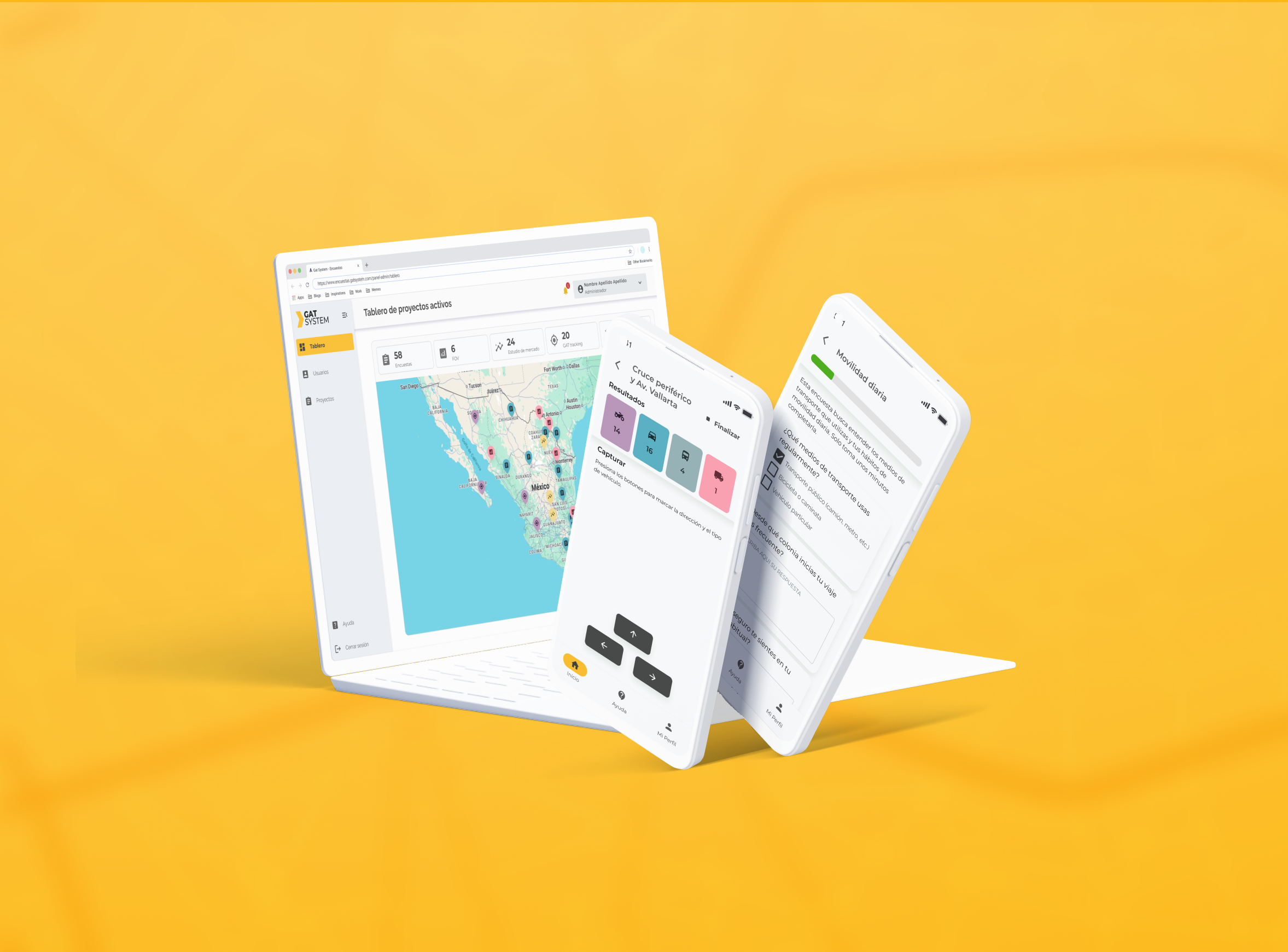
GAT System
Product Designer